
Gravel Routes in Ruka-Kuusamo
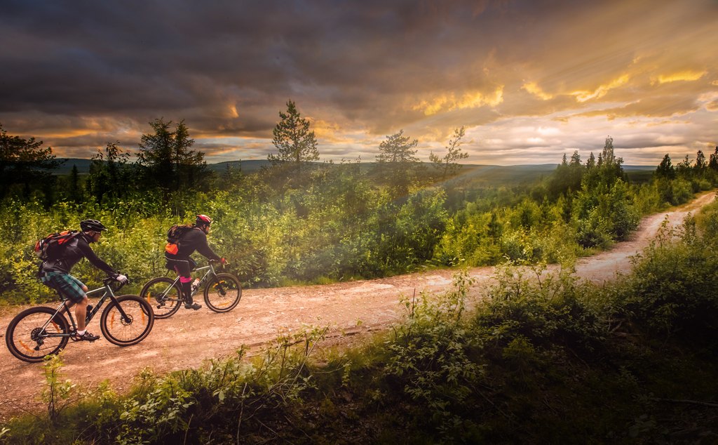
19 self-guided routes
Find your gravel route in Ruka-Kuusamo
Quiet forest roads, clear lakes and northern hills create routes for everything from a short introduction to a demanding full-day ride.
Find your route
Choose by starting point, time, effort and route format. All routes are self-guided.
Ride times are based on Komoot estimates and rounded up to the next 15 minutes.
Routes and original route information provided by Ruka-Kuusamo Tourist Association through Komoot.
Routes starting in Ruka are shown by default. Routes from Kuusamo, Käylä, Oivanki or Vuotunki require travel to another starting point in the region, so a car or taxi may be needed. Point-to-point routes also require return transport.
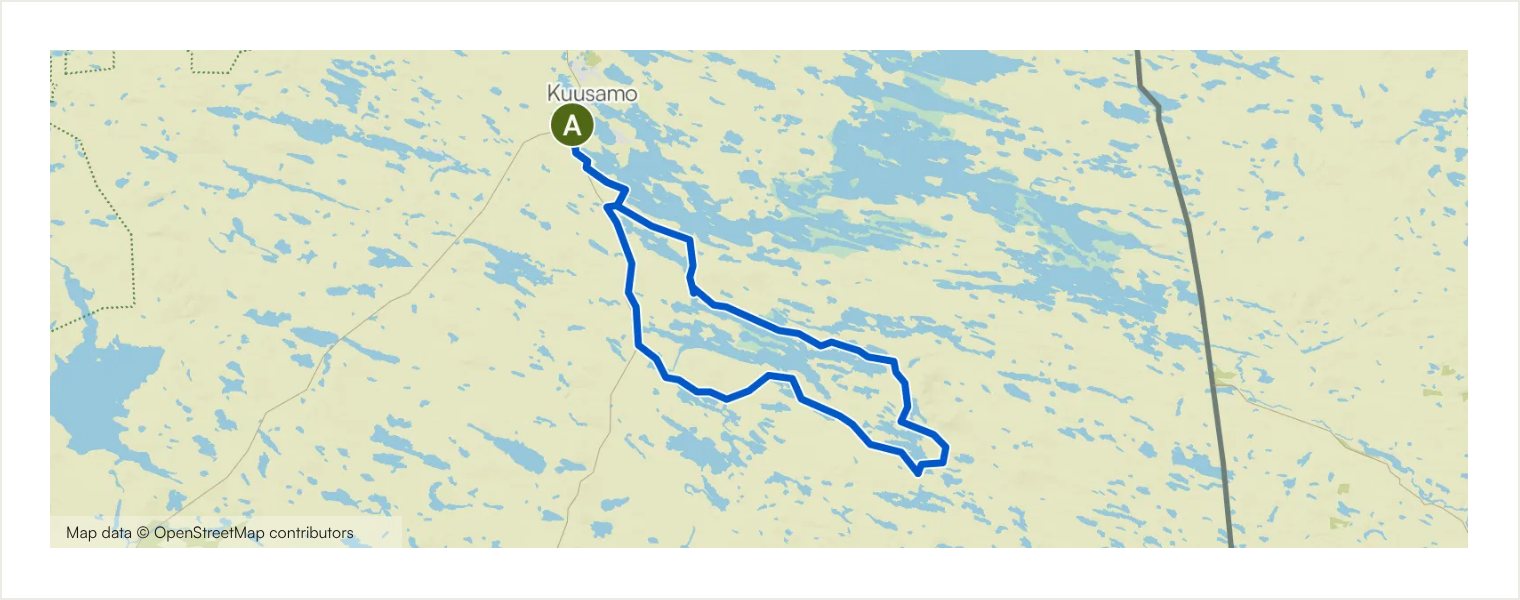
The Salpa Line and Iivaara Circuit
Circular · Starts at Karhuntassu Tourism and Culture Centre, Kuusamo
A long circular ride from Kuusamo into the historic landscapes of the Salpa Line and the hills around Iivaara. Firm gravel roads lead past restored wartime structures, quiet lakes and northern forest, with the option of leaving the bike for a short hike to Iivaara’s viewpoint. The return includes Poussunkoski and its well-equipped rest area before rejoining the outward route near Vanttajärvi.
Route details and practical notes
Surface types: Road: 71.5 km; Main road: 9.56 km; Track: 3.53 km; Cycleway: 1.36 km; Singletrack: 463 m; Street: 123 m; Unpaved track: 63.8 km; Asphalt: 21.2 km; Paved track: 1.55 km; Unknown surface: < 100 m
Main highlights: Karhuntassu Tourism and Culture Centre; Salpa Line trenches at Vanttajankannas; Lahtela lean-to shelter
Practical note: Allow a full day and carry generous food and water. Rest shelters are available at Lahtela, Hiltusentie and Poussunkoski. Take suitable walking shoes if you plan to hike on Iivaara. A short trail section near the end can be poor in wet weather.
Routes and original route information: Ruka-Kuusamo Tourist Association via Komoot.
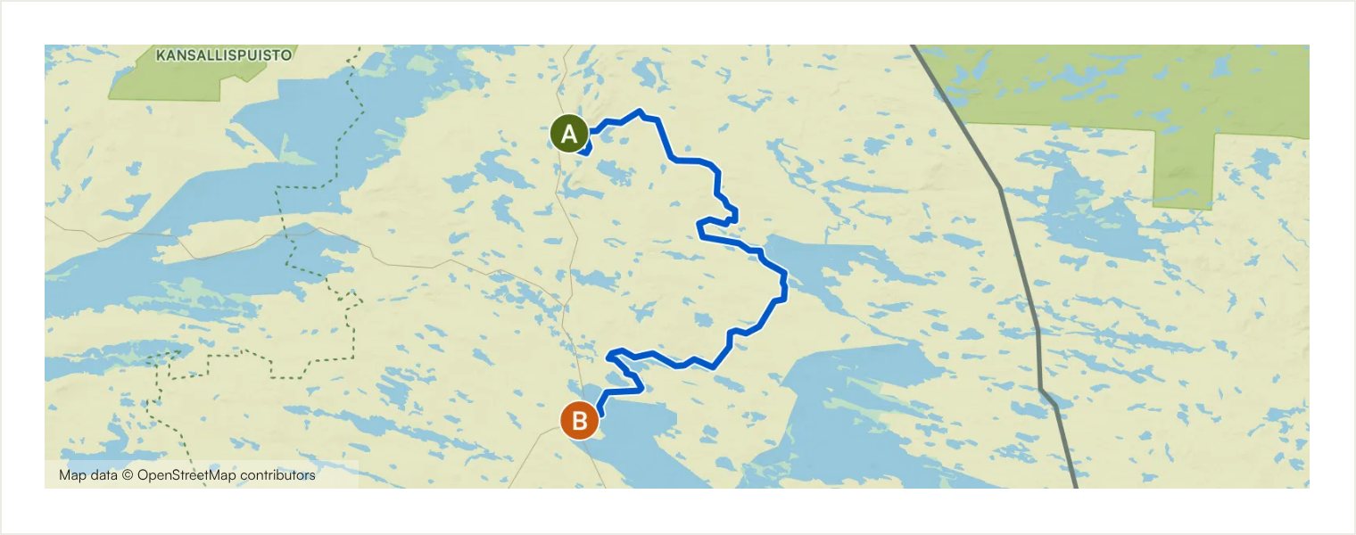
Ruka–Määttälänvaara–Kuusamo
Point-to-point · Starts at Ruka village
The eastern connection between Ruka and Kuusamo follows a varied line through Vuosseli and the southern edge of Määttälänvaara. It combines quiet paved lanes, forest roads, compact gravel and narrower trail sections before approaching Kuusamo through Kirkkosaari and the lakeside town landscape. The one-way format makes it a useful link between the two main gravel hubs.
Route details and practical notes
Surface types: Road: 51.0 km; Track: 11.3 km; Cycleway: 6.98 km; Street: 1.03 km; Access road: < 100 m; Singletrack: < 100 m; Unpaved track: 41.3 km; Asphalt: 17.4 km; Paved track: 7.57 km; Compacted gravel: 3.57 km; Unknown surface: 720 m
Main highlights: Ruka inflatable water park; Ruka village; Lapland rock formations; Scenery along Vuotungintie; Bridge to Kirkkosaari island; Kirkkosaari island near Kuusamo centre; Kuusamo town centre and lakeshore; Karhuntassu Tourism and Culture Centre
Practical note: Plan return transport or combine the ride with the western Kuusamo–Oivanki–Ruka connection. Watch for potholes on the worn asphalt near Vuosseli and follow the route carefully in Komoot at forest-road junctions. Carry food and water for the longer point-to-point ride.
Routes and original route information: Ruka-Kuusamo Tourist Association via Komoot.
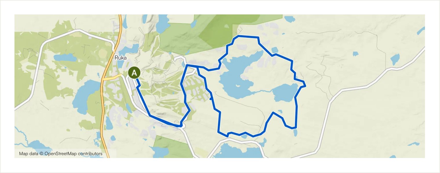
Vuosselijärvi Circuit
Circular · Starts at Ruka village
A compact circuit from Ruka village to Vuosseli, with winding gravel tracks, lake views and a clear sense of the surrounding fells. Around 58% of the route is unpaved. Most of the climbing comes from the return from Vuosseli to Ruka, making this short route more energetic than the distance alone suggests.
Route details and practical notes
Surface types: Track: 12.8 km; Cycleway: 8.59 km; Singletrack: 343 m; Street: 139 m; Road: < 100 m; Unpaved track: 13.1 km; Asphalt: 8.01 km; Paved track: 722 m; Unknown surface: < 100 m
Main highlights: Ruka village; Vuosseli trail; Vuosseli Outdoor Trail; Lammintupa Café; Lake Vuosselijärvi scenery; Rokovankallio Lapp hut and rest area; Vuosseli Outdoor Trail underpass; Lake Vuosselijärvi; View from the Vuosseli Outdoor Trail towards Ruka; Lapland rock formations; Ruka inflatable water park
Practical note: Several cafés, including Lammintupa, can offer a break when open; check seasonal opening times before departure. The final climb back to Ruka is sustained, so choose an easy pace early in the ride. Carry water outside service opening hours.
Routes and original route information: Ruka-Kuusamo Tourist Association via Komoot.
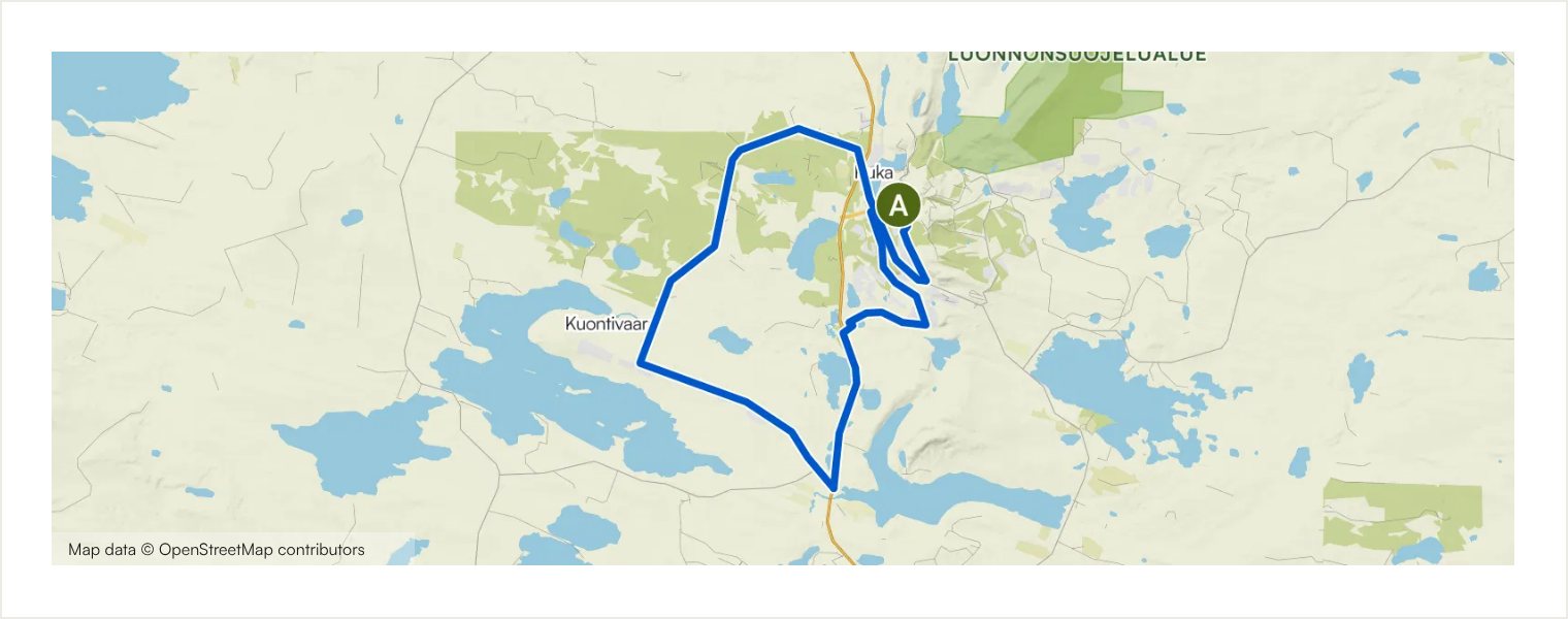
Tour de Kesäjärvi
Circular · Starts at Ruka village
An enjoyable short loop from Ruka through Talvijärvi, Kuontivaara and the small forest lakes around Kesäjärvi. Gravel roads and compact tracks make up most of the route, with paved connections and a few narrower sections. It is a practical choice for a shorter ride while still giving a varied impression of the Ruka landscape.
Route details and practical notes
Surface types: Road: 10.5 km; Cycleway: 3.34 km; Main road: 2.56 km; Track: 2.46 km; Singletrack: 2.25 km; Street: 575 m; Unpaved track: 10.8 km; Compacted gravel: 4.30 km; Asphalt: 4.18 km; Paved track: 2.19 km; Unknown surface: 170 m
Main highlights: Ruka inflatable water park; Ruka village; Lapland rock formations; Lake view in Finnish Lapland; Winding gravel road; Small lake in a Finnish forest
Practical note: Use extra care on the short Kemijärventie sections and at road crossings. The surface mix includes narrow trail and uneven gravel, so a gravel bike with suitable tyres is preferable. Carry water even though the route is short.
Routes and original route information: Ruka-Kuusamo Tourist Association via Komoot.
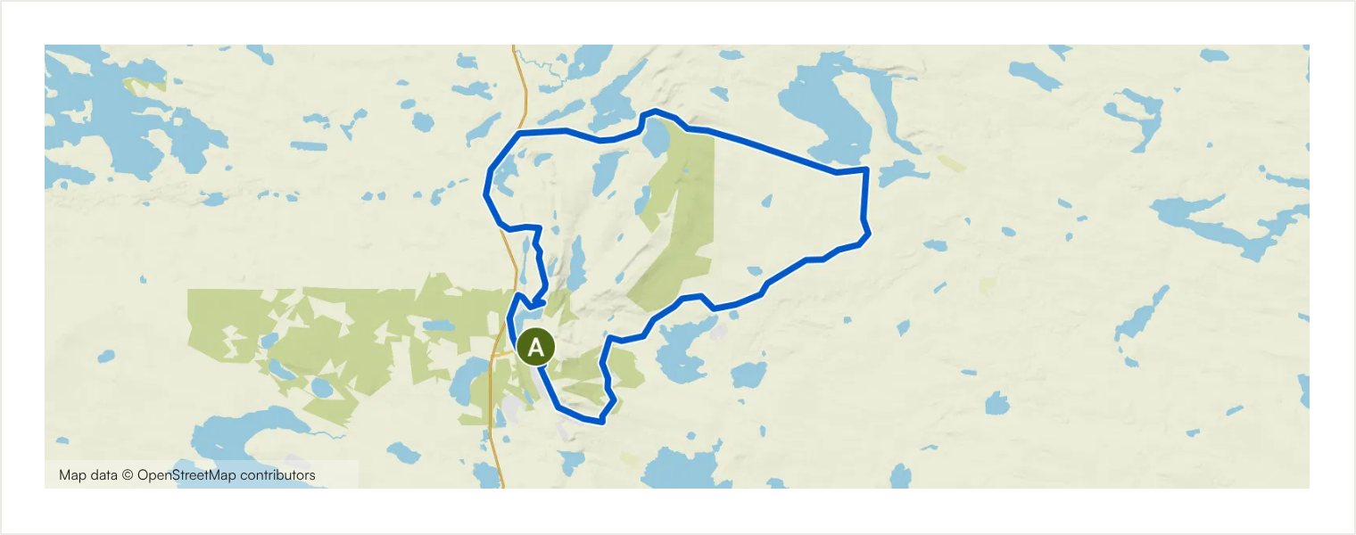
Konttainen Circuit
Circular · Starts at Ruka village
This hilly loop heads from Ruka through Vuosseli and Virkkula to the landscapes around Konttainen. The route mixes gravel roads, paved country roads and shorter trail sections, with views over Konttaisjärvi and the surrounding ridges. A picnic stop near Konttainen can be combined with a short walk to the viewpoint before the return to Ruka.
Route details and practical notes
Surface types: Road: 17.6 km; Cycleway: 6.22 km; Main road: 1.47 km; Street: 1.15 km; Track: 789 m; Singletrack: 707 m; Asphalt: 14.1 km; Unpaved track: 8.16 km; Compacted gravel: 3.57 km; Paved track: 2.04 km; Unknown surface: < 100 m
Main highlights: Ruka inflatable water park; Ruka village; Lapland rock formations; Lake Konttaisjärvi and Konttainen view; Moose on a forest road; Lake view in Finnish Lapland
Practical note: Expect several meaningful climbs despite the moderate distance. Secure the bike and use suitable footwear if walking to the viewpoint. Road surfaces vary, and the final return includes further climbing, so keep some energy in reserve.
Routes and original route information: Ruka-Kuusamo Tourist Association via Komoot.
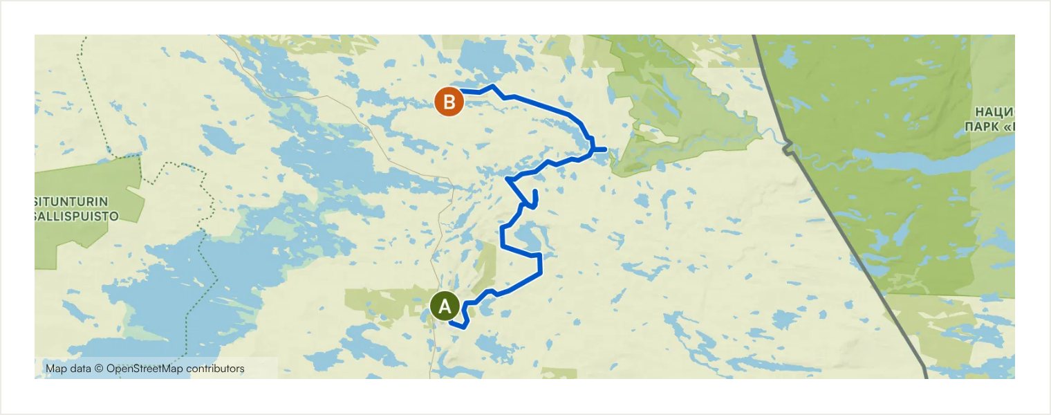
Ruka–Käylä
Point-to-point · Starts at Ruka village
A scenic one-way connection from Ruka to Käylä through Vuosseli, Virkkula, Konttainen and Halosenvaara. Fast gravel roads alternate with paved lanes and narrower forest sections, while Kumpuvaara shelter and the Käylänkoski rapids add natural stopping points. The route can also be ridden in the opposite direction.
Route details and practical notes
Surface types: Road: 37.9 km; Track: 4.56 km; Cycleway: 4.31 km; Singletrack: 1.68 km; Street: 344 m; Asphalt: 29.6 km; Unpaved track: 11.2 km; Compacted gravel: 7.21 km; Paved track: 813 m; Unknown surface: < 100 m
Main highlights: Ruka inflatable water park; Ruka village; Lapland rock formations; Excellent gravel road; Kumpuvaara shelter; Käylänkoski rapids; Käylä village
Practical note: Arrange return transport or combine the route with another connection. Services are concentrated at Ruka and Käylä, so carry water and food between them. Some forest sections are narrow and require careful navigation in Komoot.
Routes and original route information: Ruka-Kuusamo Tourist Association via Komoot.
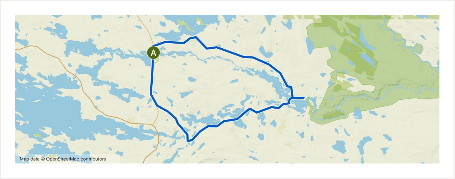
Kitkajoki Loop
Circular · Starts at Käylä village
A relatively gentle loop from Käylä through the lake and river landscapes around Juuma. The route is mostly paved, with a shorter gravel section on Riekamontie, but the quiet roads and northern scenery make it a relaxed option for riders who prefer smoother surfaces. Käylänkoski provides a memorable finish close to village services.
Route details and practical notes
Surface types: Road: 32.2 km; Street: 739 m; Singletrack: < 100 m; Asphalt: 29.0 km; Unpaved track: 3.99 km
Main highlights: Käylä village; Lake Säkkilänjärvi; Lake Juumajärvi; Käylänkoski rapids
Practical note: This is one of the smoothest routes in the collection, but it still requires independent navigation and normal road awareness. Juuma is a good place for a break when services are open. Carry water outside village opening hours.
Routes and original route information: Ruka-Kuusamo Tourist Association via Komoot.
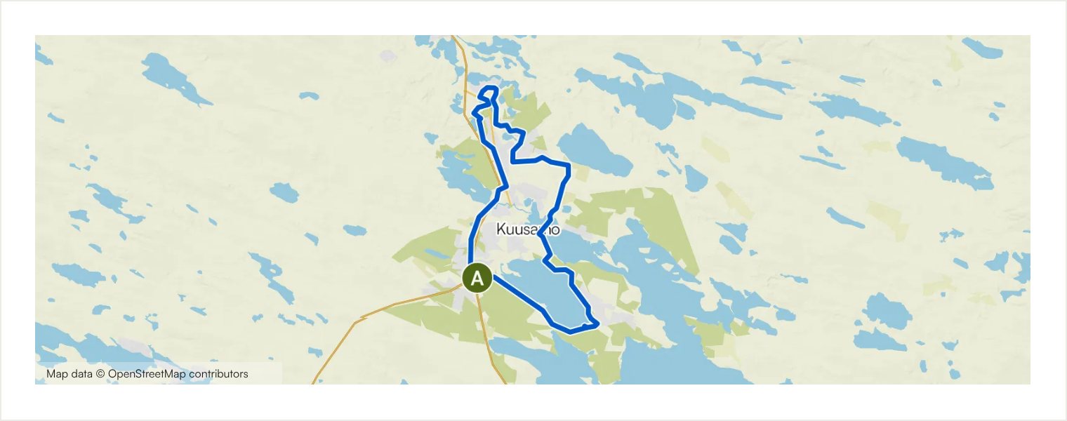
Kuusamo Village Loop
Circular · Starts at Karhuntassu Tourism and Culture Centre, Kuusamo
An accessible introduction to the Kuusamo gravel network, following lakeside paths, quiet streets and easy gravel through Kirkkosaari, Kolvanki and Nilo. The route stays close to town services and has very little climbing. Kuusamon Tropiikki and the public beach at Pieni Helilampi offer convenient break options.
Route details and practical notes
Surface types: Cycleway: 11.5 km; Street: 4.49 km; Singletrack: 2.98 km; Track: 752 m; Road: 665 m; Off-network section: 601 m; Access road: 131 m; Paved track: 12.4 km; Asphalt: 4.24 km; Unpaved track: 2.98 km; Unknown surface: 1.46 km
Main highlights: Karhuntassu Tourism and Culture Centre; Kuusamo town centre and lakeshore; Kirkkosaari island near Kuusamo centre; Bridge to Kirkkosaari island
Practical note: A good choice for beginners who are comfortable riding independently. There are barriers where motor traffic is restricted; pass them carefully and respect local access rules. The route includes short unpaved and narrow-path sections, so it is not entirely asphalt.
Routes and original route information: Ruka-Kuusamo Tourist Association via Komoot.
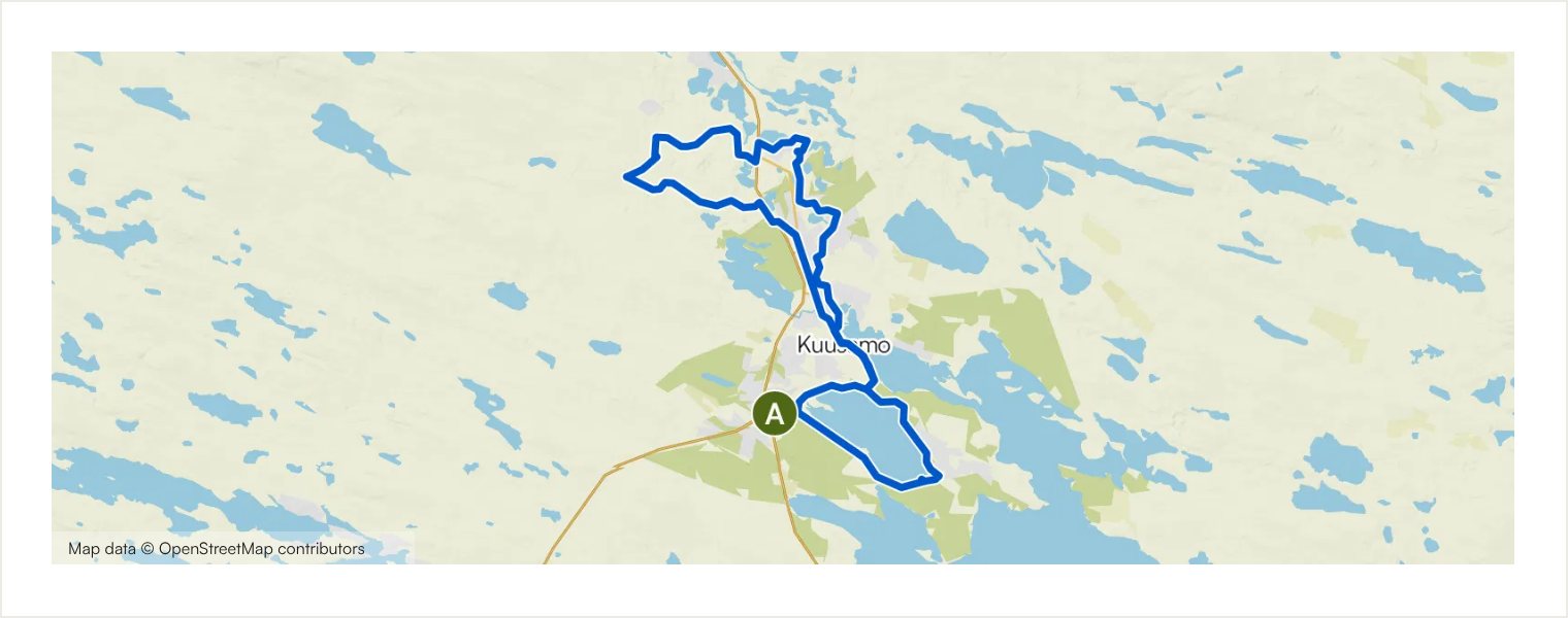
Peeking into Kuusamo
Circular · Starts at Karhuntassu Tourism and Culture Centre, Kuusamo
A low-climbing tour of Kuusamo’s urban edge, combining paved cycleways, quiet streets, hiking paths and gravel around Hirsikangas. Lakeside sections near Torankijärvi and the town centre keep the ride varied while services remain close. It is a popular local evening-style route and a practical first look at the area.
Route details and practical notes
Surface types: Cycleway: 16.4 km; Track: 5.44 km; Road: 2.95 km; Singletrack: 2.31 km; Street: 1.28 km; Main road: 130 m; Access road: < 100 m; Off-network section: < 100 m; Paved track: 16.3 km; Unpaved track: 7.51 km; Asphalt: 4.19 km; Unknown surface: 563 m
Main highlights: Kuusamo town centre and lakeshore; Karhuntassu Tourism and Culture Centre
Practical note: The route is easy in fitness terms, but several small path junctions make navigation in Komoot important. Expect mixed surfaces rather than continuous gravel. Town services provide flexible break and refill opportunities.
Routes and original route information: Ruka-Kuusamo Tourist Association via Komoot.
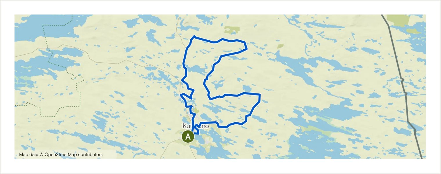
Northeastern Kuusamo
Circular · Starts at Karhuntassu Tourism and Culture Centre, Kuusamo
A demanding long loop through the forested hills and lakes northeast of Kuusamo. Roughly 55% is gravel or otherwise unpaved, while the remainder uses paved roads and cycleways. Narrow forest tracks and a dense network of side roads create a genuine backcountry feel before the route returns through the Kuusamo town area.
Route details and practical notes
Surface types: Road: 47.0 km; Track: 12.4 km; Cycleway: 12.2 km; Main road: 3.39 km; Singletrack: 2.55 km; Street: 2.49 km; Access road: < 100 m; Unpaved track: 34.9 km; Asphalt: 31.8 km; Paved track: 12.0 km; Compacted gravel: 658 m; Unknown surface: 564 m
Main highlights: Karhuntassu Tourism and Culture Centre; Kuusamo centre along Ouluntaival; Forest trail; Forest stream
Practical note: Carry enough food and water for a full-day ride. Navigation needs close attention at numerous forest-road junctions. This is not suitable for a road bike despite the paved share, and conditions on unpaved sections may change after rain or forestry work.
Routes and original route information: Ruka-Kuusamo Tourist Association via Komoot.
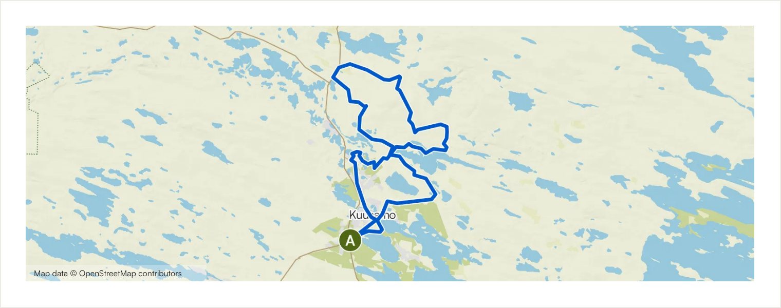
Nissinvaara Circuit
Circular · Starts at Karhuntassu Tourism and Culture Centre, Kuusamo
A varied circuit from Kuusamo towards Nissinvaara and Lake Nissinjärvi. The route uses sections of the blue- and brown-marked Nissinvaara trail, supplemented by gravel roads and quieter urban connections. Forest paths, lake scenery and the return through Kirkkosaari make this a rewarding half-day option with a balanced mix of surfaces.
Route details and practical notes
Surface types: Road: 17.6 km; Track: 14.8 km; Cycleway: 9.92 km; Singletrack: 3.24 km; Street: 585 m; Access road: 174 m; Main road: 147 m; Unpaved track: 19.1 km; Asphalt: 15.4 km; Paved track: 8.56 km; Compacted gravel: 2.40 km; Unknown surface: 939 m; Cobblestones: < 100 m
Main highlights: Kuusamo town centre and lakeshore; Kirkkosaari island near Kuusamo centre; Bridge to Kirkkosaari island; Forest trail; Forest stream; Scenery along Vuotungintie; The French Café; Kuusamo centre along Ouluntaival; Karhuntassu Tourism and Culture Centre
Practical note: Some trail sections are shared with mountain bikers and trail runners; adjust speed and give way appropriately. Surfaces range from paved paths to uneven forest track. Kuusamo services and The French Café can provide break options when open.
Routes and original route information: Ruka-Kuusamo Tourist Association via Komoot.
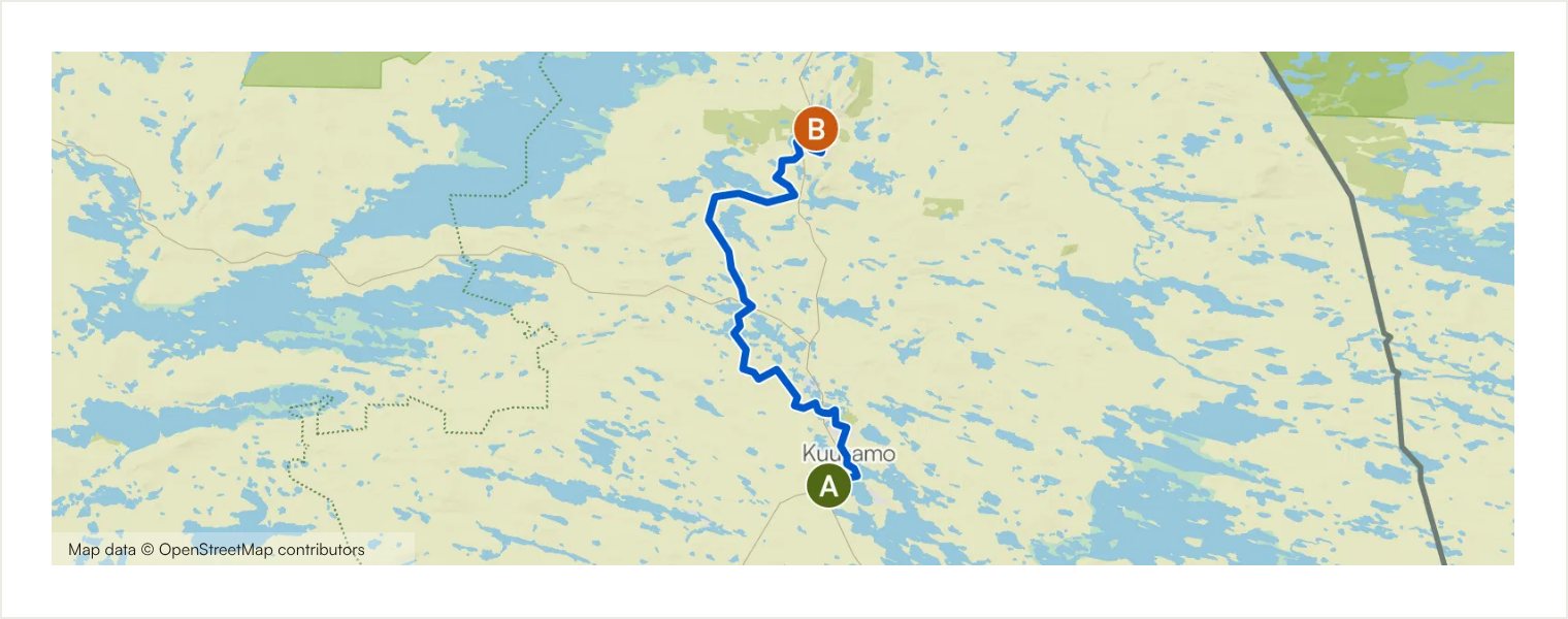
Kuusamo–Oivanki–Ruka
Point-to-point · Starts at Karhuntassu Tourism and Culture Centre, Kuusamo
The western one-way connection from Kuusamo to Ruka passes through Oivanki and the striking ridge landscape of Junganharju. Much of the gravel is clear and fast, with lakeside views and a varied approach to Ruka. Shorter trail and off-network sections add technical interest and make the route more demanding than its distance suggests.
Route details and practical notes
Surface types: Road: 23.9 km; Cycleway: 10.4 km; Track: 8.64 km; Street: 2.66 km; Singletrack: 1.32 km; Main road: 317 m; Off-network section: < 100 m; Access road: < 100 m; Unpaved track: 24.5 km; Paved track: 10.2 km; Compacted gravel: 8.64 km; Asphalt: 3.42 km; Alpine track: 281 m; Unknown surface: 195 m
Main highlights: Karhuntassu Tourism and Culture Centre; Kuusamo town centre and lakeshore; Gravel road along a ridge between lakes; View over Lake Kesäjärvi; Lapland rock formations; Ruka village; Ruka inflatable water park
Practical note: Arrange transport for the opposite direction or combine this with the eastern connection. Some sections may require dismounting or pushing. Carry water and food, follow the route carefully in Komoot around Oivanki and respect any temporary access restrictions.
Routes and original route information: Ruka-Kuusamo Tourist Association via Komoot.
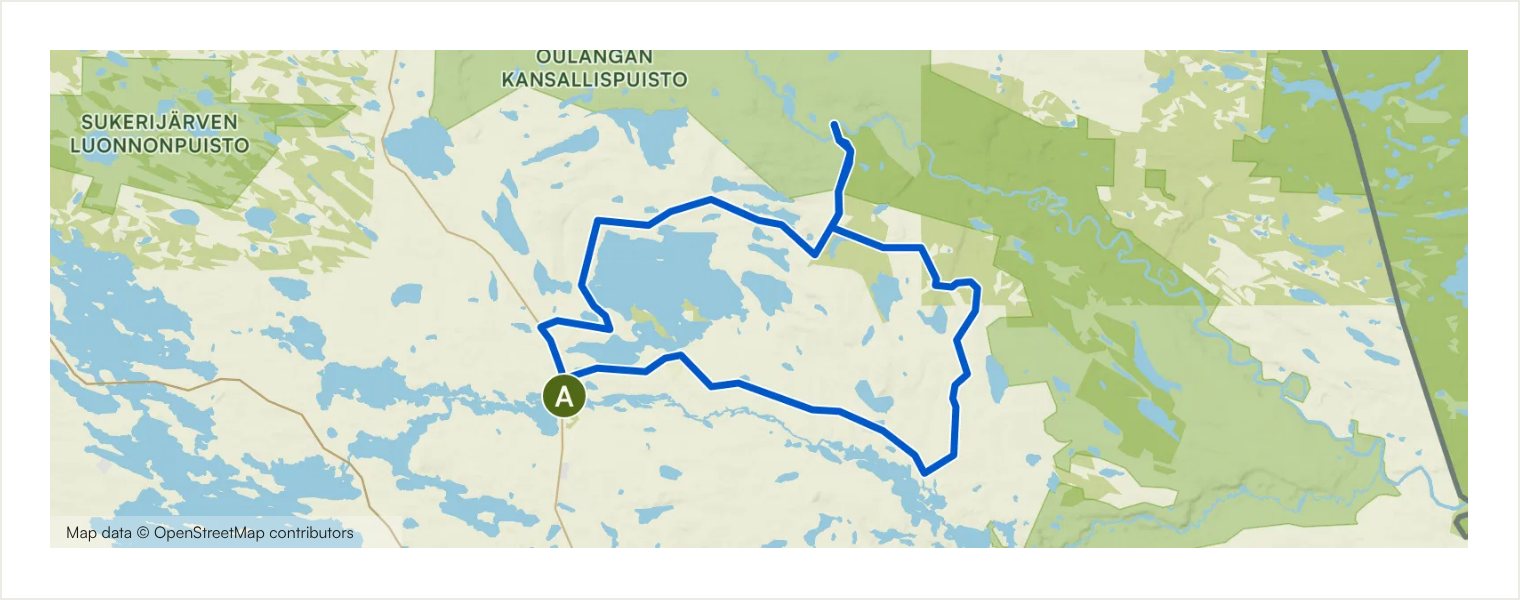
Kiutaköngäs Circuit
Circular · Starts at Käylä village
A scenic circuit from Käylä through the Kitkajoki, Juuma and Oulanka landscapes. Quiet gravel and paved roads connect two of the area’s best-known nature destinations: the Little Bear’s Trail area and Kiutaköngäs. The cycling distance is manageable, but the route rewards extra time for short walks to suspension bridges, rapids and viewpoints.
Route details and practical notes
Surface types: Road: 34.1 km; Track: 10.1 km; Street: 272 m; Asphalt: 21.0 km; Unpaved track: 13.2 km; Compacted gravel: 10.1 km; Paved track: 188 m
Main highlights: Käylä village; Käylänkoski rapids; Oulanka Visitor Centre and Kiutaköngäs rapids
Practical note: Käylä provides useful services at the start and finish. Bring walking shoes if visiting Myllykoski or Kiutaköngäs on foot. Early-season gravel can be soft or muddy; avoid riding when the surface would be damaged.
Routes and original route information: Ruka-Kuusamo Tourist Association via Komoot.
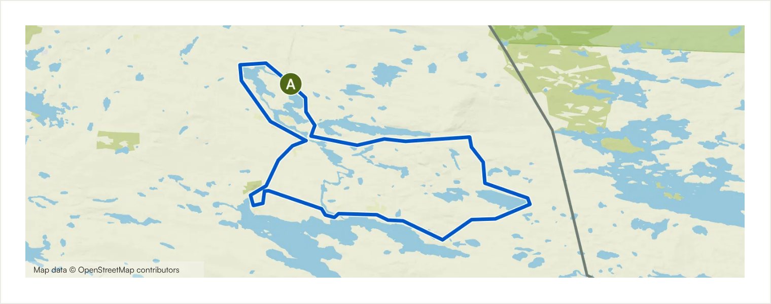
A Peek at Kuntivaara
Circular · Starts at Pohjolan Pirtti, Vuotunki
A remote-feeling loop east of Ruka, beginning in the historic village of Vuotunki close to Finland’s eastern border. The ride passes the old Myllykoski power station, the cultural landscapes of Määttälänvaara and long stretches of compact gravel around Kuntivaara. The road-based format keeps the riding flowing while the surroundings feel distinctly northern.
Route details and practical notes
Surface types: Road: 57.0 km; Compacted gravel: 29.9 km; Asphalt: 16.5 km; Unpaved track: 9.93 km; Paved track: 733 m
Main highlights: Pohjolan Pirtti & Kievari; Myllykoski hydroelectric power station; Isokenkäisten Klubi; Bear watching opportunity (advance booking only)
Practical note: Services are limited, so check opening times at Pohjolan Pirtti and other businesses and carry your own water and food. Bear-watching visits require a separate advance reservation and are not part of this self-guided route. Stay on public roads and respect the border-area environment.
Routes and original route information: Ruka-Kuusamo Tourist Association via Komoot.
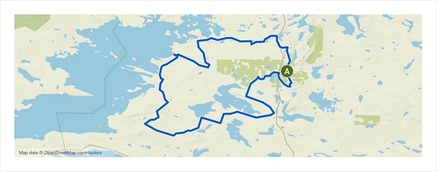
Kitka Circuit
Circular · Starts at Ruka village
A substantial Ruka-based loop to the shores of the clear Lake Kitkajärvi. Long unpaved stretches, narrow forest roads and winding gravel tracks create an adventurous ride, balanced by lake views and a return through the familiar Ruka landscape. The distance and climbing make this a full half-day or unhurried day ride for experienced cyclists.
Route details and practical notes
Surface types: Road: 37.8 km; Track: 15.6 km; Cycleway: 3.54 km; Street: 2.74 km; Singletrack: 1.99 km; Main road: 418 m; Off-network section: 338 m; Unpaved track: 48.8 km; Paved track: 7.11 km; Asphalt: 3.58 km; Compacted gravel: 2.52 km; Unknown surface: 392 m; Alpine track: < 100 m
Main highlights: Lake view near Ruka; View of Ruka; Small lake in a Finnish forest; Lapland rock formations; Ruka village
Practical note: The route includes a short section on busy Kemijärventie and several remote forest-road junctions. Carry sufficient food, water, tools and a power bank. Wet weather can make the unpaved majority slower and more demanding.
Routes and original route information: Ruka-Kuusamo Tourist Association via Komoot.
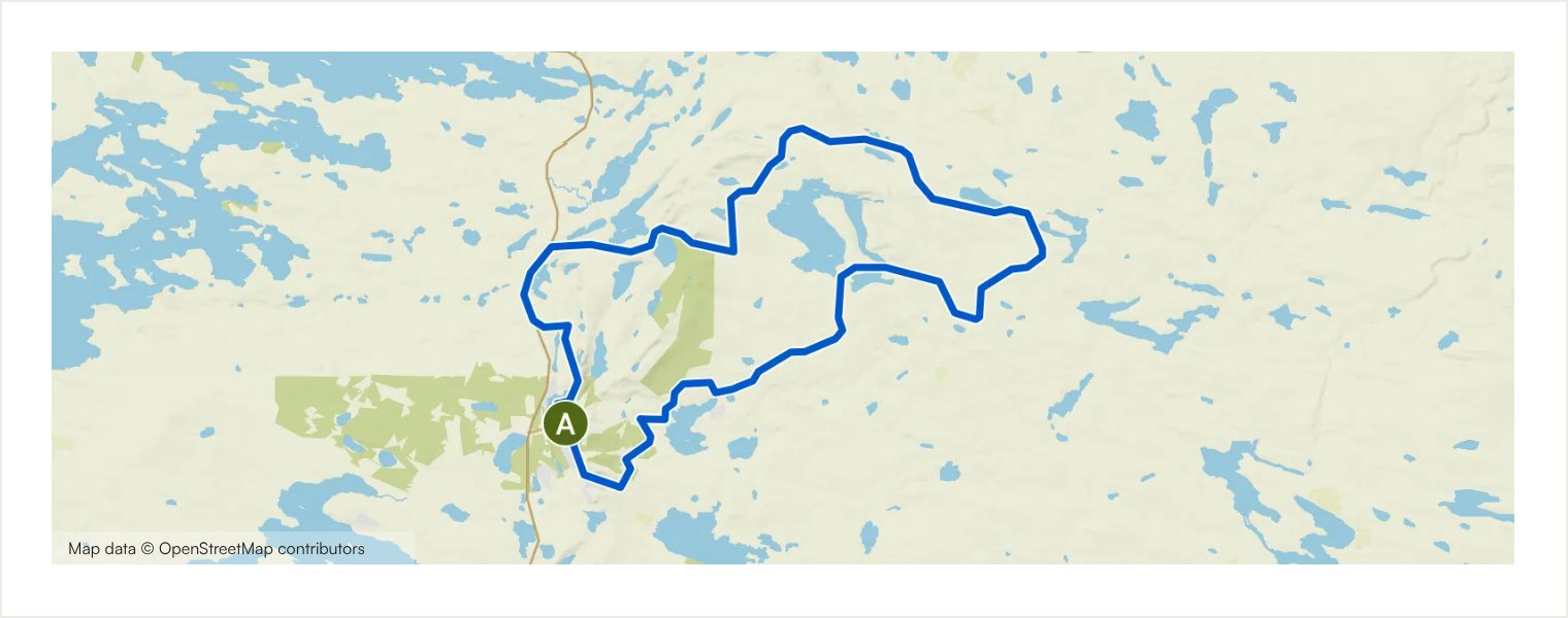
Tour de Valtavaara
Circular · Starts at Ruka village
A hilly circuit around Valtavaara and Konttainen, two of Ruka’s most impressive outdoor landscapes. The route is roughly half paved, with forest roads, gravel and shorter trail sections adding variety. Nearly 500 metres of ascent and a steep climb near Konttainen make this a compact but demanding ride with rewarding lake and fell views.
Route details and practical notes
Surface types: Road: 28.8 km; Track: 7.40 km; Cycleway: 3.15 km; Main road: 2.03 km; Street: 1.31 km; Singletrack: 511 m; Off-network section: < 100 m; Unpaved track: 19.3 km; Asphalt: 13.3 km; Compacted gravel: 8.84 km; Paved track: 1.65 km; Unknown surface: 151 m
Main highlights: Moose on a forest road; Lake Konttaisjärvi and Konttainen view; Excellent gravel road; Kumpuvaara shelter; Vuosseli Outdoor Trail underpass; Lake Vuosselijärvi; View from the Vuosseli Outdoor Trail towards Ruka; Lapland rock formations; Ruka village; Ruka inflatable water park
Practical note: Use care on Kemijärventie and control speed on descents. The steep section near Konttainen may require low gearing and confident handling. Carry water and basic repair equipment even though the route returns to Ruka within a few hours.
Routes and original route information: Ruka-Kuusamo Tourist Association via Komoot.
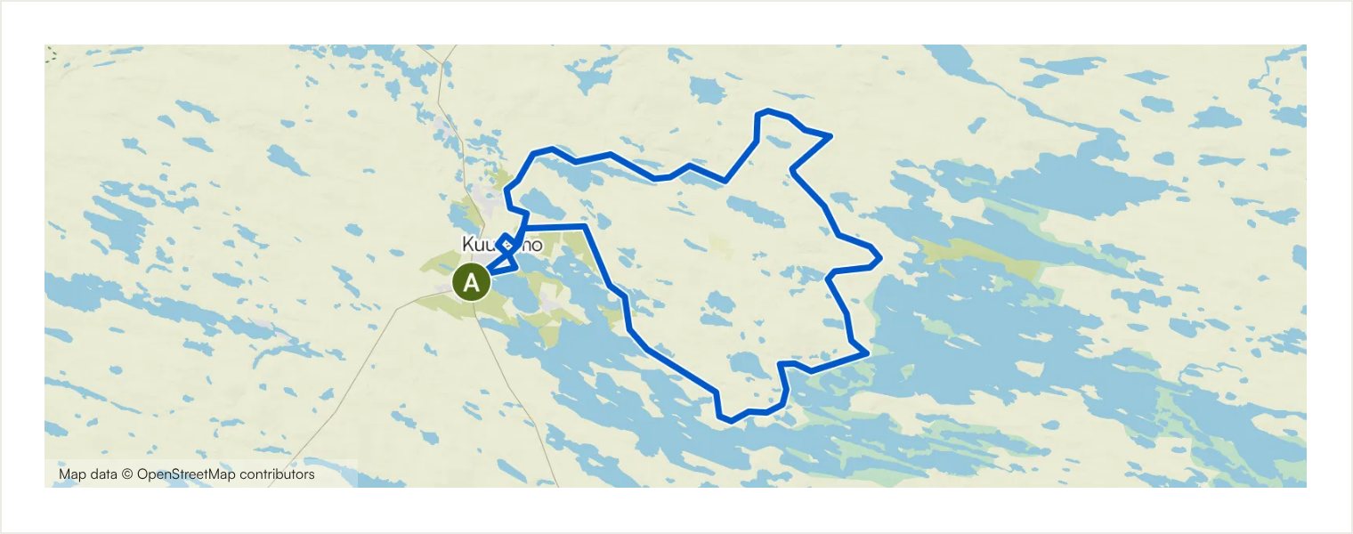
Kuusamo Lakes Circuit
Circular · Starts at Karhuntassu Tourism and Culture Centre, Kuusamo
A long but flowing circuit through Kuusamo’s lake, village and hill landscapes. Starting at Karhuntassu, the route follows Toranki, Kuusamojärvi and quieter country roads before returning through the town. Compact gravel, unpaved roads and paved connections are well balanced, making this a scenic distance ride without highly technical terrain.
Route details and practical notes
Surface types: Road: 56.0 km; Cycleway: 8.29 km; Street: 2.59 km; Track: 613 m; Access road: 108 m; Compacted gravel: 22.3 km; Unpaved track: 18.6 km; Asphalt: 16.4 km; Paved track: 9.55 km; Unknown surface: 731 m; Cobblestones: < 100 m
Main highlights: Karhuntassu Tourism and Culture Centre; Kuusamo town centre and lakeshore; Kirkkosaari island near Kuusamo centre; Bridge to Kirkkosaari island; Scenery along Vuotungintie; The French Café; Kuusamo centre along Ouluntaival
Practical note: The distance requires good basic fitness, but services in and around Kuusamo offer several break options, including cafés when open. Expect one more noticeable climb. Carry water and food between service points and check opening times in advance.
Routes and original route information: Ruka-Kuusamo Tourist Association via Komoot.
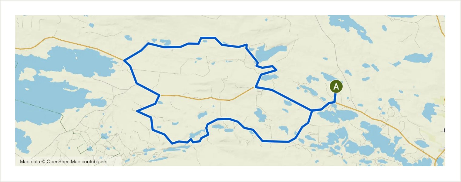
Tour de Oivanki
Circular · Starts at Oivanki Youth and Nature Tourism Centre
A technical gravel adventure from Oivanki, halfway between Kuusamo and Ruka. Fast forest road gives way to narrower, winding track and more demanding sections around Ruoppivaara before the route returns through varied northern woodland. Könkäänniemi kota provides a natural break point, and nearby routes can be combined only with careful planning.
Route details and practical notes
Surface types: Track: 14.6 km; Road: 12.1 km; Main road: 8.62 km; Off-network section: 1.06 km; Access road: < 100 m; Unpaved track: 25.0 km; Asphalt: 10.3 km; Unknown surface: 1.06 km
Main highlights: Oivanki Youth and Nature Tourism Centre; Könkäänniemi Kota
Practical note: Some sections may require pushing the bike, and the route includes off-network ground and uneven forest track. Carry water, food and repair equipment; services are limited away from Oivanki. Follow gates and access restrictions carefully.
Routes and original route information: Ruka-Kuusamo Tourist Association via Komoot.
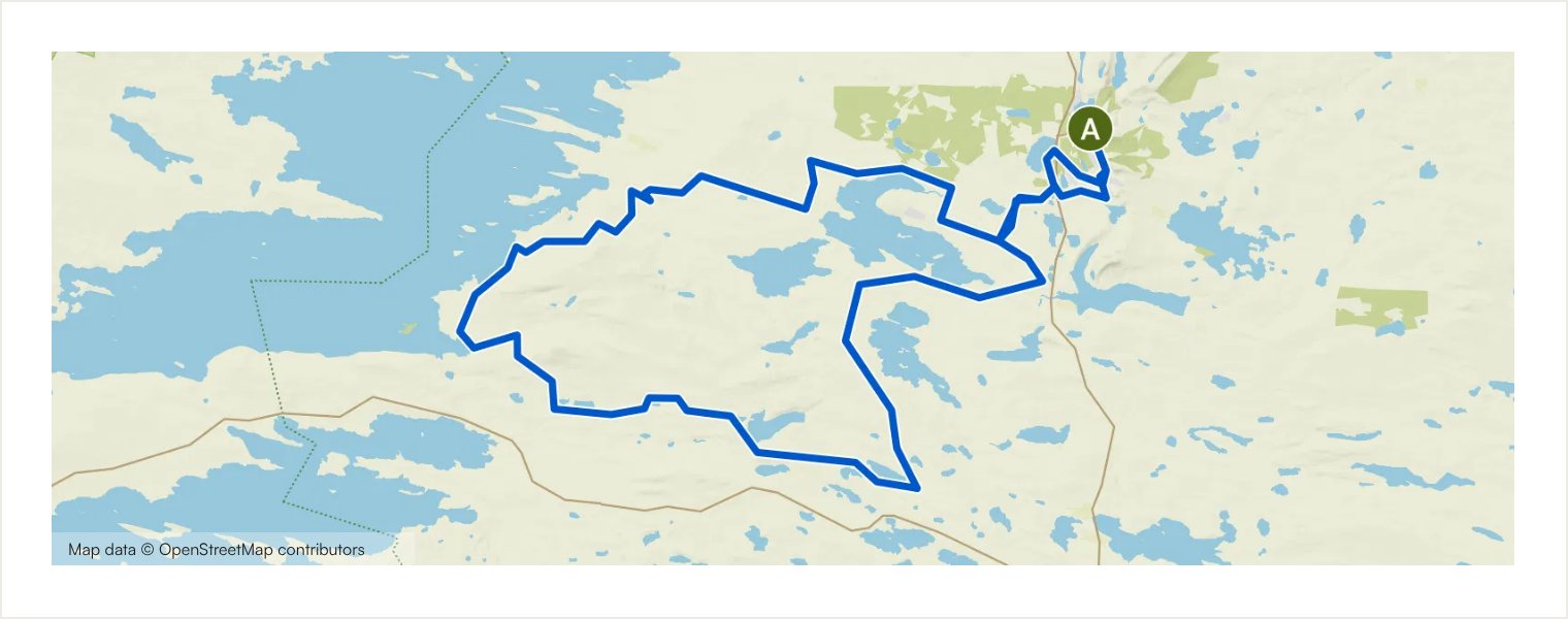
Kouvervaara Experience
Circular · Starts at Ruka village
The collection’s most technical route combines gravel with substantial mountain-bike trail around Kouvervaara, Kitka, Naatikkavaara and Oivanki. Steep climbs, demanding descents, wet sections and a long boardwalk create a serious backcountry day. The views from Kouvervaara and the shores of Kitka are exceptional, but the route is intended for experienced riders.
Route details and practical notes
Surface types: Road: 29.9 km; Track: 28.5 km; Cycleway: 5.05 km; Singletrack: 3.25 km; Street: 2.69 km; Off-network section: 753 m; Unpaved track: 53.3 km; Compacted gravel: 8.59 km; Paved track: 3.86 km; Asphalt: 3.28 km; Unknown surface: 1.04 km
Main highlights: Ruka inflatable water park; Lapland rock formations; View over Lake Kesäjärvi; Small lake in a Finnish forest; Kouverpuron Laavu; Lake view; Kouervaaran Laavu shelter; Gravel track beside Lake Yli-Kitka; Lakeside beach in Finnish Lapland; Könkäänniemi Kota; Oivanki Youth and Nature Tourism Centre; Ruka village
Practical note: Do not underestimate this route. Expect pushing on steep or rough sections and use extra care on descents and wet boardwalks. Carry ample water, food, tools, spare clothing and a power bank. Early summer can be especially wet; choose another route if surfaces are soft.
Routes and original route information: Ruka-Kuusamo Tourist Association via Komoot.
No routes match all selected filters. Clear one or more filters and try again.
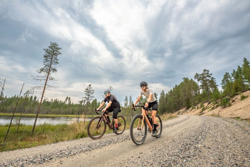
Ride at your own pace
Why gravel cycling in Ruka-Kuusamo?
Quiet forest roads connect lakes, hills and small northern settlements. Long summer light invites unhurried exploration, while autumn brings crisp air and vivid colour. Choose a route that suits your day and discover the landscape independently.
Open and follow a route in Komoot
Open the original route to review the full map and details. If the Komoot app is installed on your phone or compatible device, continue in the app for navigation.
Select View Route in Komoot.
Download the route or map before departure.
Check battery and start before leaving.
Mobile coverage may be limited. Carry a power bank on longer routes. Komoot is an external service and is not managed by Ruka Safaris.
Safety and responsibility
These routes are self-guided and no guide accompanies you. Decide whether the route matches your fitness, skills and experience. Conditions can change, and Ruka Safaris cannot guarantee that every road or trail will always be open or remain in the same condition.
Check the weather and carry water, food, suitable clothing, basic tools and puncture-repair equipment. Follow local traffic rules and respect private property, forestry operations and temporary closures. A route map is a navigation aid; it does not replace good judgement or preparation.
Frequently asked questions
No. Every route on this page is self-guided and no guide accompanies the cyclist.
Select “View Route in Komoot” on the relevant route card. The original route opens in a new browser tab, where you can review the full map and route details.
Yes. If you have the Komoot app installed, open the route in the app and use it for navigation. Save the route or map for offline use before departure and carry a power bank on longer rides.
Komoot is one suitable option because every route links to its original Komoot page. Other compatible navigation tools may also work, but the routes on this page are accessed through Komoot.
Save the route or map for offline use before departure. Some features may depend on your device, subscription or app settings, so test navigation while you still have a connection.
Some shorter routes are more approachable, especially the Kuusamo Village Loop. Check distance, ascent, surface and practical notes before choosing.
A well-maintained gravel bike is the most versatile choice. Some easier routes may suit another suitable bicycle with reliable brakes and tyres appropriate for unpaved surfaces.
Do not rely on continuous route markings. Follow the original route in Komoot and remain alert at junctions.
Carry water, food, weather-appropriate clothing, a charged phone, basic tools, a spare tube or repair plugs, a pump and a puncture repair kit. Add lights and a power bank when appropriate.
The main season is generally during the snow-free months. Conditions vary from year to year, so check current weather, road conditions and possible closures before setting out. Long summer days offer generous riding time, while autumn brings cooler temperatures and colourful landscapes.
Plan your stay in Ruka-Kuusamo
Explore accommodation in Ruka-Kuusamo and other summer activities while planning your independent cycling visit.
Need a bike in Ruka? View gravel and e-gravel rental prices and request availability.